Dogskin Fishing
Live weather, depth contours, catch logging, offline maps, Apple Watch — free on the App Store
Built by the Lodge, for Guests and for Anyone Fishing Canadian Shield Lakes
We've been running trips at Dogskin for 55+ years and watching guests try every fishing app out there. None of them worked offline, knew our depth contours, or remembered your catches past the current season. So we built our own. Free for guests, free for anyone who wants it.
Free. iPhone, iPad, and Apple Watch. Requires iOS 17.0 or later.
Everything You Need on the Water
Six features, all built specifically for Canadian shield fishing. Offline-first. Sync when you're online. Your data stays yours.
Live Weather & Pressure
Real-time conditions at Dogskin Lake — temperature, wind, humidity, cloud cover, UV. A 24-hour barometric pressure history chart with trend arrow. 10-day forecast. Refreshes every 10 minutes during the season.
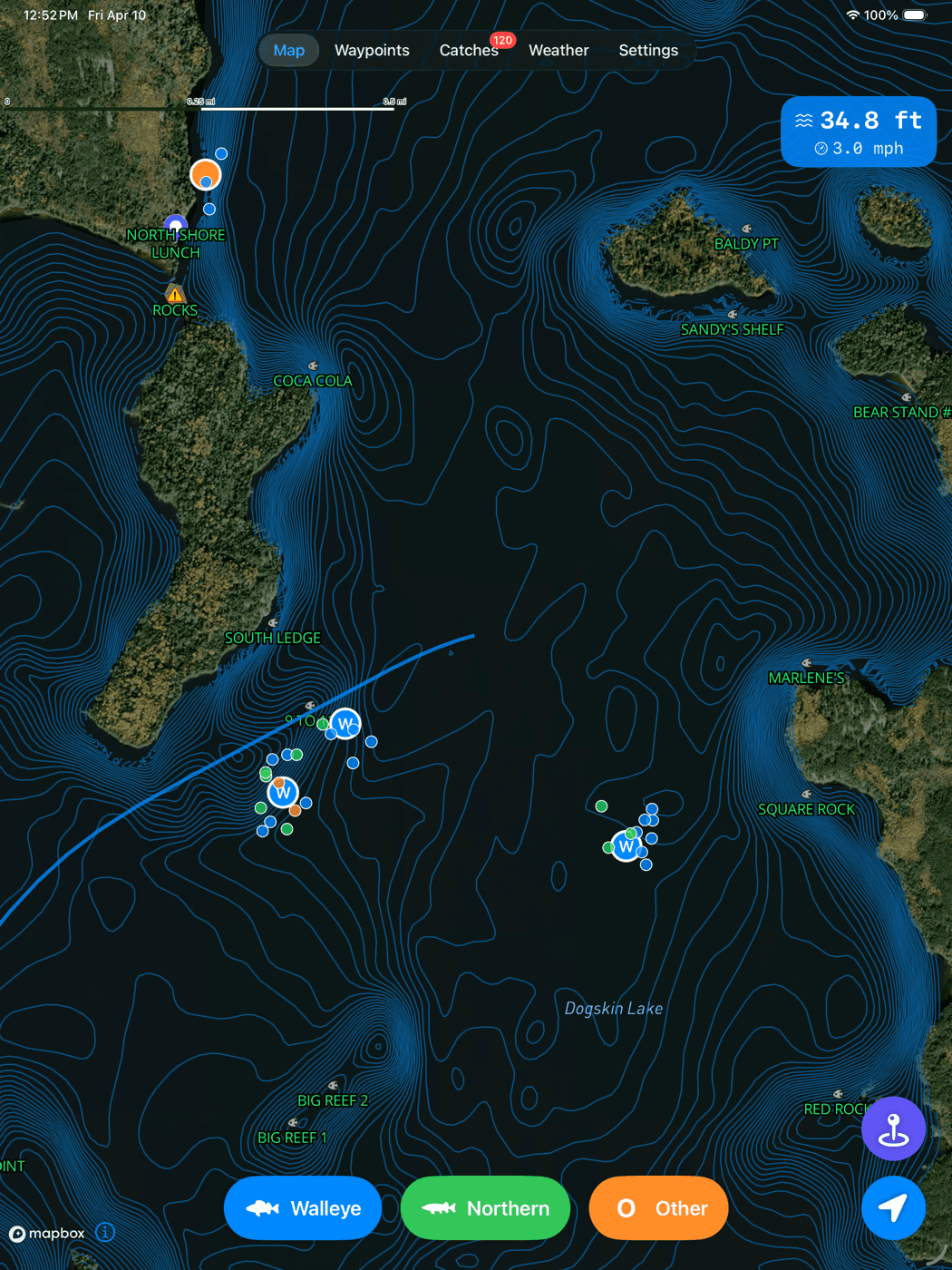
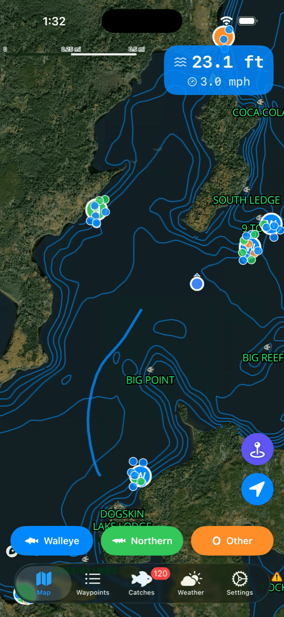
Depth Finder
Real-time lake depth at your boat position on Dogskin Lake and Mannifrank. Shown alongside your speed at the top of the map. Read the drop-off under your boat as you drift a ledge.
Log Every Catch
Species, length, lure, depth, water temperature, notes, photos. GPS location and lake depth captured automatically. Catches show up as markers on the map — find the same spot again next year.
Detailed Offline Maps
Download the full lake map before your trip or over Starlink at the lodge. Depth contours on a satellite base, named waypoints, catch markers, everything. Works with zero cell service.
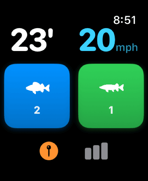
Apple Watch Companion
Quick-log a walleye or northern pike from your wrist. Glance at your depth and speed. Perfect for when your iPhone is in a dry bag and your hands are wet. Syncs back when in range.
Flexible Sign-In
Sign in with Apple, Google, email, or stay anonymous as a guest. All four are equally supported. Upgrade from anonymous to a real account later without losing any of your data.
A Look Inside the App
Map, weather, catches, waypoints, and more. Swipe through to see each screen.
Satellite base with depth contours. Your live depth and speed at the top.
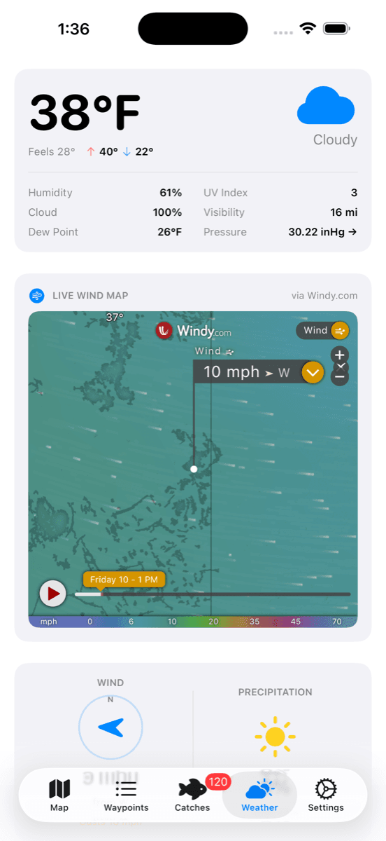
Current conditions + 24h pressure chart + 10-day forecast + animated wind map.
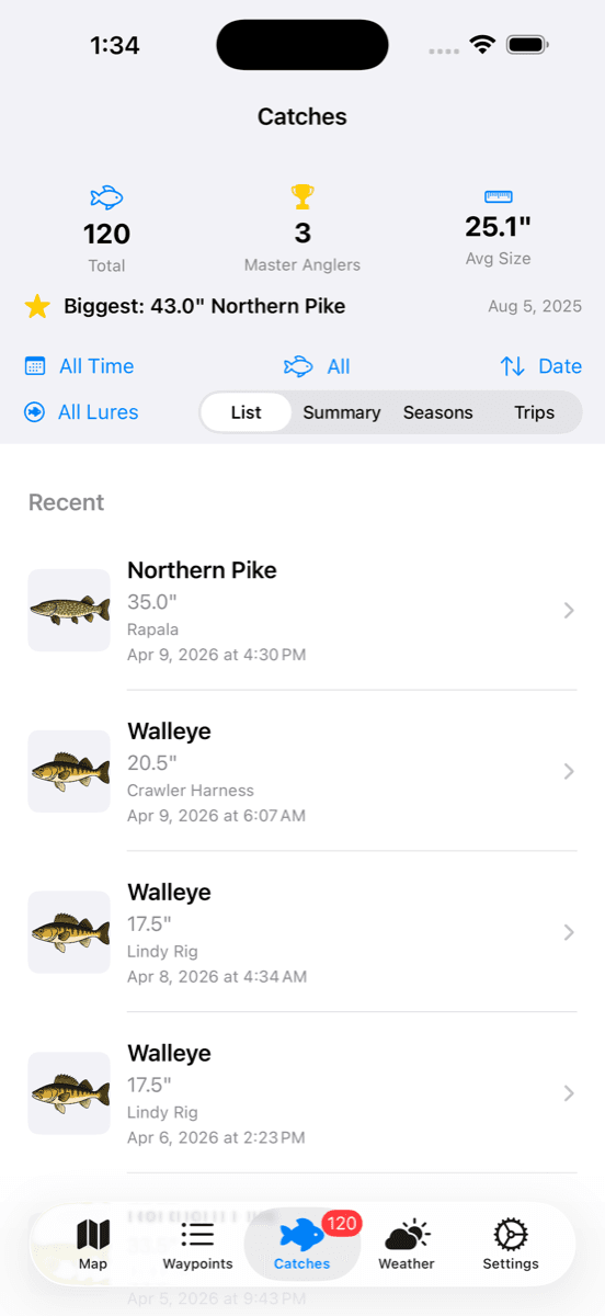
Every catch you log, forever. Biggest fish, master angler tracking, filterable by trip.
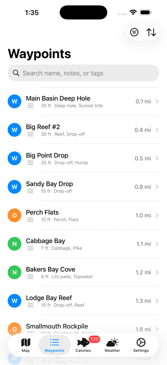
Mark productive spots. Color-coded by species. Distance from your current position.
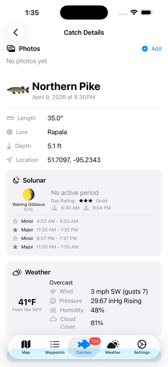
Every catch gets its own page. Photos, lure, location, time, water temp.
Every Dogskin Lake, Mapped
Full offline maps with waypoints for every lake we run. Live depth finder data on the two lakes we've surveyed.
Download Dogskin Fishing
Free on the App Store. iPhone, iPad, and Apple Watch. No ads, no tracking, no paywalls.
By using the app, you agree to our privacy policy. Questions? Call 715-955-4110.
Ready to Plan Your Adventure?
Limited weeks available for the 2026 season. Moose tags sell out years in advance.